Form H-8120-1 - Guidlines For Conductiong Tribal Consultation - Bureau Of Land Managment Page 45
ADVERTISEMENT
 1
1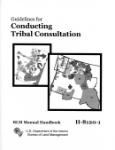 2
2 3
3 4
4 5
5 6
6 7
7 8
8 9
9 10
10 11
11 12
12 13
13 14
14 15
15 16
16 17
17 18
18 19
19 20
20 21
21 22
22 23
23 24
24 25
25 26
26 27
27 28
28 29
29 30
30 31
31 32
32 33
33 34
34 35
35 36
36 37
37 38
38 39
39 40
40 41
41 42
42 43
43 44
44 45
45COVER IMAGES are adapted from “Indian Land Areas Judicially Established 1978,”
by Frederick L. Briuer, Ph.D., and Gary A. Hebler, U.S. Army Engineer Waterways
Experiment Station, U.S. Army Corps of Engineers, based on the similarly named U.S.
Geological Survey map that “portrays results of cases before the U.S. Indian Claims
Commission or the U.S. Court of Claims in which an American Indian tribe proved its
original tribal occupancy of a tract within the continental United States.”
See .
ADVERTISEMENT
0 votes
Related Articles
Related forms
 And/or A Tunnel Site - United States Department Of The Interior - Bureau Of Land Management - 2016") Form 3830-3 - Notice Of Intent To Locate A Lode Or Placer Mining Claim(s) And/or A Tunnel Site - United States Department Of The Interior - Bureau Of Land Management - 2016
Legal
Form 3830-3 - Notice Of Intent To Locate A Lode Or Placer Mining Claim(s) And/or A Tunnel Site - United States Department Of The Interior - Bureau Of Land Management - 2016
Legal


 Form 1221-2 - Manual Transmittal Sheet - United States Department Of The Interior Bureau Of Land Management
Legal
Form 1221-2 - Manual Transmittal Sheet - United States Department Of The Interior Bureau Of Land Management
Legal
 San Juan Islands National Monument Resource Advisory Committee Application - Bureau Of Land Management
Legal
San Juan Islands National Monument Resource Advisory Committee Application - Bureau Of Land Management
Legal


Related Categories
Parent category: Legal