Mine Design Plan Template - Ministry Of Energy And Energy Affairs Page 8
ADVERTISEMENT
 1
1 2
2 3
3 4
4 5
5 6
6 7
7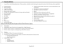 8
8 9
96. Diagrams and Plans:
i.
Layout Plan of the Mining Operations- Please produce a detailed scaled drawing showing the location of the following, where applicable:
Land boundaries
Natural and man-made watercourses, and associated berms to be
Mine boundaries
constructed
Stockpiles for unprocessed minerals
Vegetative buffers
Stockpiles for processed minerals
Offices and buildings
Berms
Hard ground surface area(s)
Roadways in the vicinity and on the site
Fuelling site (showing the location of storage tanks and bunds)
Garage for storage and maintenance of equipment
Processing Plant
Known groundwater recharge area(s)
Settling ponds
Metered and un-metered water abstraction point(s)
Silt Traps
Water-abstraction wells
Catchments
Water pumps
Benches
Water discharge points
Pits
Any other feature(s) on the site
Check Dams
Storm-water drains
Please note that this plan must be approved by the Water Resources Agency
ii.
Topography
Topographic map of the site (to be prepared by a Land Surveyor)
Profile of mine site prior to mining activity along a North-South transect
Profile of mine site prior to mining along an East-West transect
iii.
Geology
A Geological Map of the proposed mining
Geological cross-sections from the surface to the
o North-South direction and
o East-West direction
o Topsoil
o Overburden and
o Minable minerals
Page 8 of 9
ADVERTISEMENT
0 votes
Related Articles
Related forms


 Form Lp-1-instr - Instructions For Preparing And Filing The Certificate Of Limited Partnership - Department Of Commerce And Consumer Affairs
Legal
Form Lp-1-instr - Instructions For Preparing And Filing The Certificate Of Limited Partnership - Department Of Commerce And Consumer Affairs
Legal
 Form Miosha-300a - Summary Of Work-related Injuries And Illnesses - Michigan Department Of Licensing And Regulatory Affairs
Legal
Form Miosha-300a - Summary Of Work-related Injuries And Illnesses - Michigan Department Of Licensing And Regulatory Affairs
Legal
 Form Dnp-1 - Articles Of Incorporation - State Of Hawaii Department Of Commerce And Consumer Affairs
Legal
Form Dnp-1 - Articles Of Incorporation - State Of Hawaii Department Of Commerce And Consumer Affairs
Legal

 Application For Amended Certificate Of Authority Of A Foreign Non-profit Corporation - District Of Columbia Department Of Consumer And Regulatory Affairs
Legal
Application For Amended Certificate Of Authority Of A Foreign Non-profit Corporation - District Of Columbia Department Of Consumer And Regulatory Affairs
Legal
 Certificate To Amend Application For Certificate Of Registration For A Foreign Limited Liability Company Form - Department Of Consumer And Regulatory Affairs, District Of Columbia
Legal
Certificate To Amend Application For Certificate Of Registration For A Foreign Limited Liability Company Form - Department Of Consumer And Regulatory Affairs, District Of Columbia
Legal


Related Categories
Parent category: Legal