Performance And Accountability Report - Fiscal Year 2013 - Federal Aviation Administration - U.s. Department Of Transportation Page 20
ADVERTISEMENT
 1
1  2
2  3
3 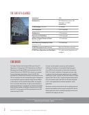 4
4  5
5  6
6  7
7  8
8  9
9  10
10  11
11  12
12 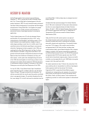 13
13  14
14  15
15  16
16 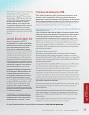 17
17  18
18  19
19 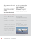 20
20 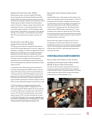 21
21 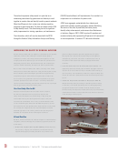 22
22  23
23  24
24 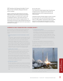 25
25  26
26 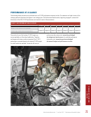 27
27  28
28  29
29 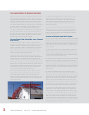 30
30 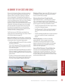 31
31  32
32  33
33  34
34 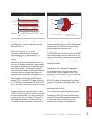 35
35 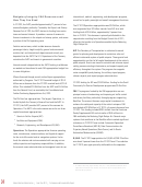 36
36  37
37  38
38 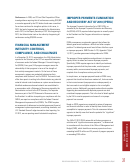 39
39  40
40  41
41 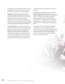 42
42  43
43  44
44  45
45  46
46 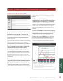 47
47  48
48 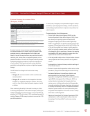 49
49 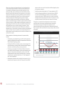 50
50 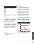 51
51  52
52 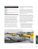 53
53 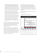 54
54 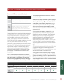 55
55 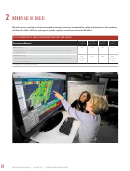 56
56  57
57  58
58  59
59  60
60 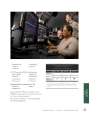 61
61  62
62  63
63  64
64  65
65 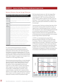 66
66  67
67  68
68  69
69 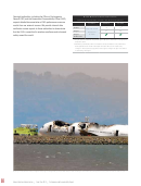 70
70  71
71  72
72  73
73  74
74  75
75  76
76  77
77  78
78  79
79  80
80  81
81  82
82  83
83  84
84  85
85  86
86  87
87  88
88  89
89  90
90  91
91  92
92  93
93  94
94  95
95  96
96  97
97  98
98 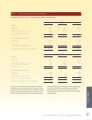 99
99  100
100  101
101  102
102  103
103  104
104  105
105  106
106  107
107  108
108  109
109  110
110  111
111  112
112  113
113  114
114  115
115  116
116  117
117  118
118  119
119  120
120  121
121  122
122  123
123  124
124  125
125  126
126  127
127  128
128  129
129  130
130  131
131 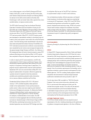 132
132  133
133  134
134  135
135  136
136  137
137  138
138  139
139  140
140  141
141  142
142  143
143  144
144  145
145  146
146  147
147  148
148  149
149  150
150 complete deployment of 642 ADS-B ground radio stations
gains. PBN helps reduce fuel burn and emissions through more
in FY 2014. As more aircraft equip with ADS-B receivers, we will
continuous climbs and descents that eliminate the need for
be able to realize its benefits more fully throughout the national
gradually “stepping up” to ascend or gradually “stepping down”
airspace system.
to descend. The FAA is supporting the use of PBN to provide
greater flexibility in the management of air traffic. This year, the
FAA produced 677 PBN routes and procedures.
Performance-Based Navigation (PBN)
Another cornerstone of NextGen is PBN. It allows for navigation
In May 2013, we launched the PBN Dashboard at
routes and procedures that use the satellite-based global
gov/nextgen/pbn/dashboard. The website provides PBN
positioning system (GPS) to determine and share precise aircraft
implementation and usage statistics for all major airports in
location information.
the national airspace system that have had PBN procedures
published for them. The data is captured on a periodic basis and
PBN routes and instrument procedures enable aircraft to fly
displayed in an easy-to-interpret format for interested parties.
more direct routes, thereby increasing efficiency and capacity
UNMANNED AIRCRAFT: A NEW FAA FRONTIER
NextGen transformations are not the only major innovation in the
in humanitarian search and rescue operations, such as finding
offing at the FAA. In the FAA Modernization and Reform Act of
stranded climbers or a missing child.
2012 (FMRA), Congress directed the agency to integrate Unmanned
In February 2013, in accordance with the requirements of FMRA, the
Aircraft Systems (UAS) into the evolving national airspace safely and
FAA kicked off a process to select six test sites to conduct research
efficiently by 2015.
and development to assist in the integration of UAS into the national
UAS are unmanned vehicles that can be the size of toy aircraft and
airspace system. To address public concerns about privacy related
fly at low altitudes, or have the equivalent wingspan of a Boeing 737
to the UAS test sites, the FAA held a public engagement session in
and fly above 60,000 feet. For many UAS operations, an observer
April to help determine the required privacy approach for the test
on the ground or an accompanying manned “chase” aircraft is
sites. The final, approved privacy approach will be included in the
contractual agreement between the FAA and test site operators. In
required to maintain visual contact with the UAS vehicle at all times,
providing the pilot-in-command who is controlling the UAS with
addition, the agency is consulting with other government agencies
“sense and avoid” capabilities in relation to other aircraft.
about the privacy policies that will shape UAS implementation more
broadly beyond UAS test sites.
UAS have been deployed mainly for “public interest” military and
border patrol purposes since 1990. But in July 2013, for the first time,
(Editorial note: On November 7, 2013, the FAA published the UAS
the FAA certified two small UAS for commercial use.
Roadmap, Comprehensive Plan, and Final Privacy Policy for the UAS
Test Sites. All three may be found at
These initial commercial UAS operations in Arctic locations will be
initiatives/uas/.)
cost effective and environmentally friendly, and because of the lack
of dense air traffic, they will reduce the risk to manned aviation. The
Scan Eagle, manufactured by Boeing subsidiary Insitu, will survey
ocean ice floes and migrating whales in Arctic oil exploration areas.
AeroVironment’s PUMA will support emergency response crews in
oil-spill monitoring and wildlife surveillance over the Beaufort Sea.
UAS are less expensive to operate than manned aircraft and may
be used for a wide variety of purposes, including monitoring natural
disasters, such as forest fires; tracking dangerous weather patterns,
such as hurricanes; conducting crop monitoring; performing scientific
research for National Aeronautics and Space Administration (NASA)
and National Oceanic and Atmospheric Administration (NOAA), as
well as for universities; supporting law enforcement; and assisting
NASA’s Global Hawk UAS aircraft flies above the equatorial Pacific, collecting
data that will help researchers identify how changes in humidity in the upper
atmosphere may affect climate. Photo: NASA, March 2013.
18
|
|
Federal Aviation Administration
Fiscal Year 2013
Performance and Accountability Report
ADVERTISEMENT
0 votes
Related Articles
Related forms
 Form Hud-2063 - Schedule Of Federal Housing Administration Debentures Authorized And Requisitioned - Original Issue - Office Of Housing Federal Housing Commissioner - U.s. Department Of Housing And Urban Development
Legal
Form Hud-2063 - Schedule Of Federal Housing Administration Debentures Authorized And Requisitioned - Original Issue - Office Of Housing Federal Housing Commissioner - U.s. Department Of Housing And Urban Development
Legal
 Form 4530 - Registration And Amendments Of Foreign Charter Operators Under Part 380 Of The Regulations Of The Department Of Transportation - U.s. Department Of Transportation
Legal
Form 4530 - Registration And Amendments Of Foreign Charter Operators Under Part 380 Of The Regulations Of The Department Of Transportation - U.s. Department Of Transportation
Legal


 - U.s. Department Of Transportation") Faa Form 8110-26 - Supplemental Type Inspection Report (stir) - U.s. Department Of Transportation
Legal
Faa Form 8110-26 - Supplemental Type Inspection Report (stir) - U.s. Department Of Transportation
Legal
 Form Hud-2537 - Mortgagee's Application For Partial Settlement - Multifamily Mortgage - Office Of Housing Federal Housing Commissioner - U.s. Department Of Housing And Urban Development
Legal
Form Hud-2537 - Mortgagee's Application For Partial Settlement - Multifamily Mortgage - Office Of Housing Federal Housing Commissioner - U.s. Department Of Housing And Urban Development
Legal


Related Categories
Parent category: Business