Middle East/north Africa Map Worksheet Page 2
ADVERTISEMENT
 1
1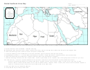 2
2Middle East/North Africa Map
Name __________________
Class Period ____
Key
River
Mountains
Capital City
! Other City
Directions: Carefully label and color the following. (Hint: Write small as there are many things to locate in a small area)
a. Shade the ocean and seas blue. Label the following:
Mediterranean Sea, Red Sea, Gulf of Aden, Arabian Sea, Gulf of Oman, Persian Gulf, Black Sea, Caspian Sea, Aegean Sea
b. Label the following straits: Strait of Hormuz, Bosporus, Dardanelles
c. Trace the following rivers in blue from end to end and label: Tigris, Euphrates, Nile (what is shown)
d. Make brown symbols (
) for and label the following mountains: Zagros Mountains, Atlas Mountains, Taurus Mountains
e. Label the following physical features: Arabian Peninsula, Rub’ al-Khali, Plateau of Anatolia
f. Label the following countries and their capital cities . Make a symbol ( ) for the capitals in the correct geographic location on your map
and name the city. Color the countries different colors (do NOT use blue for countries) based on their political boundaries:
Morocco (and Western Sahara occupied by Morocco), Algeria, Tunisia, Libya, Egypt, Turkey, Cyprus, Syria, Iraq, Iran, Kuwait,
Bahrain, Qatar, United Arab Emirates, Oman, Yemen, Saudi Arabia, Lebanon, Israel, Jordan (You do not need to label the capitals of
Lebanon, Israel, Syria and Jordan since your already did on the other side)
g. Draw and label the city of Makkah (Mecca)
h. Complete the key for the symbols used
ADVERTISEMENT
0 votes
Related Articles
Related forms


 Patient Under Investigation (pui) Short Form")


Related Categories
Parent category: Education