Middle East/north Africa Map Worksheet
ADVERTISEMENT
 1
1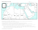 2
2Middle East/North Africa Map
Name
Class Period
Assignment #
Directions: Use the maps on pages 439, 441, 468, 522, and 532 to label and color the following.
1. Use the maps on page 468 and 522 to identify which countries belong to the Middle East/North Africa
Region. On the map below, color all the countries that are included in BOTH Middle East and North Africa
the same color. Be careful to only shade the countries of the Middle East and North Africa. DO NOT
include the Former territory of the USSR in Central Asia or the Caucasus
2. Use the maps on page 476 and 524 to label
and color the Map of Israel and Surrounding
Israel and
Areas.
Surrounding
Areas
a. Shade seas and lakes blue and label the
following bodies of water:
Dead Sea, Sea of Galilee, Mediterranean Sea,
Gulf of Suez, Gulf of Aqaba
b. Trace and label the Jordan River and Suez
Canal in blue. Use this symbol for the canal
‘ ’ ‘ ’ ‘ ’
c. Label the Sinai Peninsula.
d. Label and color Lebanon, Syria, Jordan,
Israel (and their capitals). Label and color the
part of Egypt shown. Label the
occupied/disputed territories of Golan Heights,
West Bank, and Gaza.
e. Complete the key for the symbols used.
Key
River
Canal
Capital City
ADVERTISEMENT
0 votes
Related Articles
Related forms


 Patient Under Investigation (pui) Short Form")


Related Categories
Parent category: Education